How 3D Laser Surveys Improve Project Accuracy and Efficiency
By LPD Surveys
· 02/11/2025
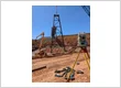
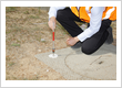
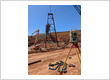
In construction, precision and efficiency are key to a successful project. Traditional surveying methods often fall short when dealing with complex sites or intricate details. 3D laser surveys offer a solution, providing highly accurate data that enhances project outcomes. This technology streamlines the surveying process, reduces errors, and saves both time and resources. So, What is 3D Laser Scanning? 3D laser scanning uses laser beams to capture precise measurements of a physical environment. The scanner emits laser beams that bounce back from surfaces, creating a point cloud—a 3D digital model of the scanned area. This model is invaluable for design, analysis, and planning, especially for large-scale or intricate sites. The result is an accurate digital record that can be revisited throughout the project. Here's how 3D Laser Surveys Help Improve Project Efficiency Improved Accuracy 3D laser scanning ensures high accuracy by capturing millions of data points within seconds. Traditional methods are more prone to human error, particularly when measuring complex or large areas. With 3D scanning, even the smallest details are captured, ensuring precise measurements for design and construction. Increased Efficiency The speed of 3D laser scanning is another major advantage. Tasks that would typically take days using traditional methods can be completed in hours. This reduces delays and allows construction teams to progress with planning and design without waiting for survey data. For example, 3D scanning surveyor Perth offers fast and reliable scanning services, keeping projects on track. Better Collaboration By providing a shared, accurate data set, 3D laser scanning fosters collaboration between architects, engineers, and contractors. Everyone works from the same information, reducing the chances of miscommunication and ensuring alignment across the project. The data can also be integrated with other technologies like Building Information Modelling (BIM), improving coordination. Cost Savings With greater accuracy and faster data collection, 3D laser scanning helps reduce errors and rework, saving time and money. Potential issues can be identified early, allowing for adjustments before construction begins. Additionally, the need for manual measurements is eliminated, reducing labour costs. Detailed As-Built Models After construction, 3D laser scanning provides as-built models, offering an exact representation of the finished project. These models are useful for facility management, future renovations, or modifications, making them a valuable asset for long-term project maintenance. Wrapping Up 3D laser scanning is versatile and can be used in various stages of a project. During planning, it captures detailed site surveys, topography, and existing structures. In the construction phase, it monitors progress and verifies alignment with the design, helping identify discrepancies early. After completion, the data can be used to create as-built models for ongoing maintenance. For remote projects or large-scale infrastructure developments, 3D surveys Perth provide comprehensive scanning solutions, capturing data from both ground and aerial perspectives. This combined approach ensures a complete view of the site, enhancing the overall accuracy of the project. 3D laser surveys are transforming construction projects by improving accuracy, efficiency, and collaboration. This technology provides precise, detailed data quickly, reducing errors and saving time and costs. For projects that demand the highest level of accuracy, 3D laser scanning survey Perth offers expert services that ensure your project stays on track and within budget. The author provides expert surveying services, specialising in a range of professional land and engineering surveys. With a deep understanding of the latest surveying techniques and technologies, they offer precise, reliable data to support infrastructure development, construction projects, and land management. Visit https://lpdsurveys.com.au/project_category/aerial-uav-drone-surveys-3d-models-photography/ for more details.
About This Author

LPD Surveys
Balcatta, Perth, Wa, Australia
LPD Surveys provides professional Licensed Land and Engineering Surveying services to a broad range of clients and sectors across Western Australia. Specialist large area mapping and construction, infrastructure and residentical surveyors. Established in Mandurah in 2017 by Jake Lampard to service l…
More Articles From This Author
How 3D Laser Scanning Improves Site Documentation

2026-07-21Good site documentation gives project teams a clear, reliable picture of what's actually there. Notes, photos, and tape-measure readings still have their place, but they tend to fall short once a building or worksite has irregular geometry.… Read More »
 Canada
 Cayman Islands
 Dominican Republic
 Hong Kong
 India
India
 Indonesia
 Ireland
 Jamaica
 New Zealand
 Singapore
 Thailand
 United Kingdom
 United States
 Vietnam
 Australia Business Directory